When it comes to surveys, there are many different types of surveys that we use in our everyday lives. However, in this article we are focusing on professional surveying solutions, which are conducted by qualified surveyors. So, if you are interested finding out more about the surveys we provide at Landform Surveys, be sure to keep reading.
What is Surveying?
By definition, surveying or land surveying is the technique, profession, and science of determining the terrestrial two-dimensional or three-dimensional positions of points and the distances and angles between them. Surveys can also be conducted on buildings and structures to assess and map the building.
What Are the Different Types of Surveys?
There are a comprehensive range of survey types, with varying purposes and applications, these include:
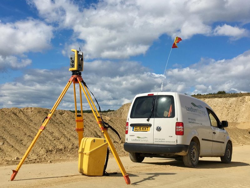
Topographic Surveys
A topographic survey, commonly known as a land, topo or terrain survey, is a vital component in the design process for a site and is used to map the boundaries, manmade and natural features, and levels of a site.
As part of a topographic survey, constraining factors such as highways and buildings adjacent to the site are also surveyed to further support the design process. Find out everything you need to know about topographic surveys here.
Measured Building Surveys
As briefly mentioned, measured building surveys involve the mapping internally and externally of buildings or structures and it can include a variety of outputs, from a basic floor plan to a detailed 3D building model. Measured building surveys can be conducted on all built structures, regardless of age.
Typically, measured building surveys are used as a basis for building reconfigurations or restoration projections, and are considered a critical part of the design process. Check out our Measured Building Surveys FAQS article to find out more about this surveying method.
Elevation Surveys
An elevation survey is used for planning and development for building work, as this surveying method provides an accurate representation of a structure and will include details on all structural openings, such as doors and windows, string courses, stone features, and vents.
Findings from elevation surveys are also used for the scheduling and planning of future maintenance work.
3D Laser Scanning Surveys
3D laser scanning surveys are a non-invasive surveying technique that collects data points from a building or structure remotely, and maps them on a grid coordinate of x, y and z.
Compared to more traditional surveying techniques, 3D laser scanning is completed at a higher speed and produces a greater level of detail, and it is considered to be one of the most efficient and accurate methods for measuring infrastructure.
BIM Surveys
BIM stands for Building Information Modelling, and it involves the capture and maintenance of data points to be shared across multiple agencies for the lifespan of the building or structure.
At its core, BIM aims to reduce waste and improve efficiency through streamlining processes and making it easier for teams to work together in a project environment. From improved coordination to reduced costs and risks, there are number of benefits of using BIM surveys, find out more about these benefits here.
Setting Out Surveys
Setting out is the process of taking points from a design and marking them out on the physical space to aid in construction projects. Setting out tends to be conducted after the architect’s plans have been finalised. Setting out is used to ensure that project designs are accurately transferred into the real world.
Why Choose Landform Surveys?
At Landform Surveys, we have years of experience in carrying out surveys. Get in touch with our surveyors today to discuss your project needs and find the right survey for you.
