A topographic survey, also known as a land, topo or terrain survey, is a vital component in the design process for a site and should be commissioned before any detailed design works take place.
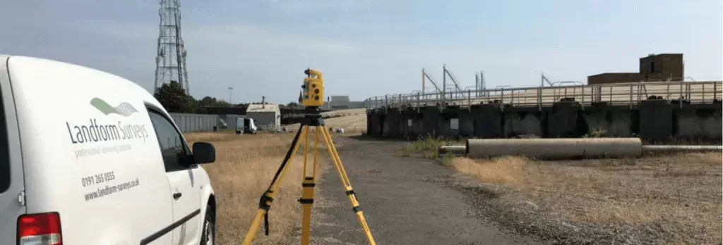
At Landform Surveys, we have vast experience in carrying out topographic surveys, and it is the core of our business. Our surveyors use Trimble S6 and S5 Robotic Total Stations, and Trimble R10 & R8 GPS receivers to carry out our surveys. These instruments are also capable of reflectorless measurement, which means we can survey previously inaccessible points. This is particularly useful for surveying heights and positions of buildings, which overlook development sites and produce streetscapes of adjacent building elevations.
We have also utilised aerial UAV drone technology to produce ground terrain and topo surveys of large sites, and are presently evaluating this method for accuracy and cost-effectiveness.
What is a topographic survey?
This type of survey maps the boundaries, manmade and natural features, and levels of a site, and is the first step in the process for the site’s development. Other constraining factors such as highways and buildings adjacent to the site are also surveyed to aid the design process.
What is it used for?
A professionally produced topo survey can be used as a legal document to define boundaries of a property. Other professionals such as architects, civil engineers and planners use them to make decisions on design and project management.
What are the benefits?
The main benefit of topographic surveys is that they help with planning and decision-making. An accurate survey will prevent costly assumptions being made about the size of the site, or about other constraints such as site levels and heights and positions of surrounding buildings.
How long does it take?
The duration depends on the size and complexity of the proposed project. Once we have surveyed your site, it takes another few days for drawings to be produced.
What can you expect from our topographic surveys?
Detail is accurately measured and the deliverables issued to meet our clients’ specific requirements or to RICS standards. These can range from simple 2D plans to detailed 3D AutoCAD drawings. To ensure the highest quality control, our surveyors edit their own surveys to ensure that all possible detail is recorded and presented correctly.
What Our Clients Say
“We have appointed Landform for several projects over the last year to prepare topographic surveys for a range of sizes of sites. We have been pleased with the quality of work carried out and have no reservation in recommending Landform, especially Eric Hinds, for similar work.”