We have provided volumetric surveys to accurately calculate stockpile volumes, extraction quantities, and volumes of earthworks.
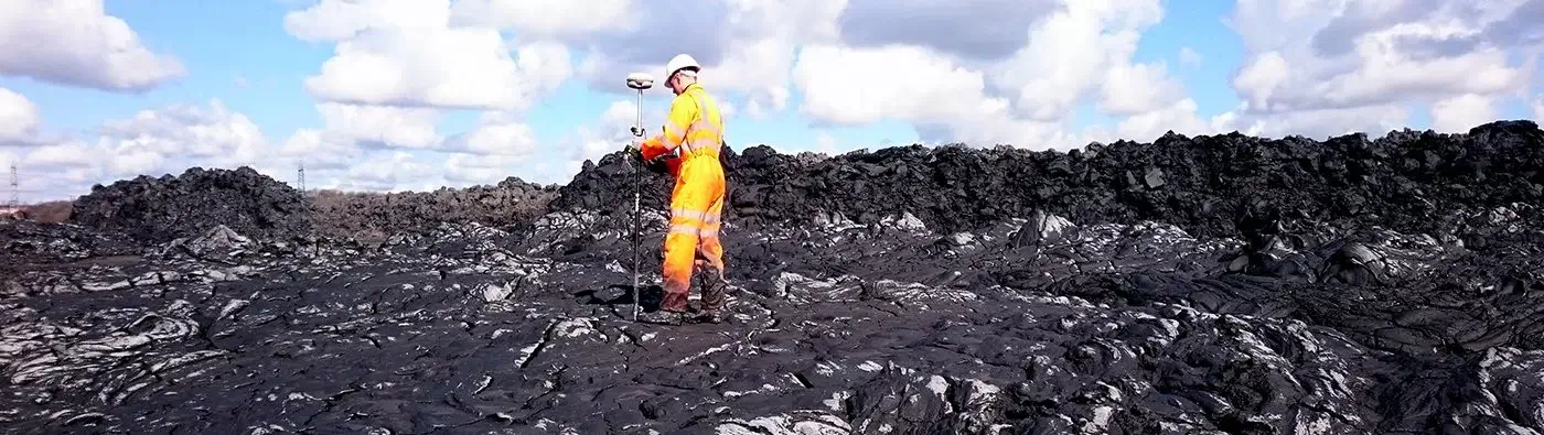
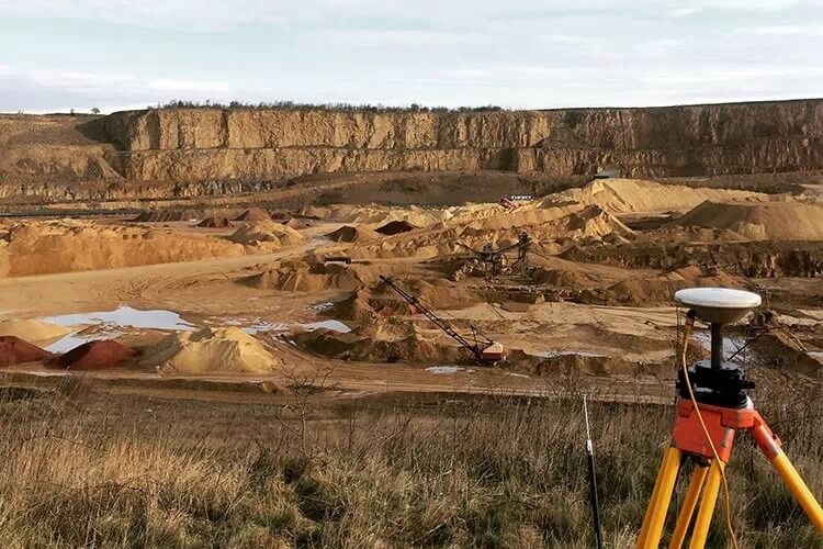
Stockpiles are measured usually using Trimble GPS receivers, but our Trimble TX8 scanner has been used to measure stockpiles that are unsafe to walk on.
We have trialled aerial UAV drone technology and use this method as an alternative or in conjunction with ground surveying techniques. This makes our volumetric surveys cost and time effective.
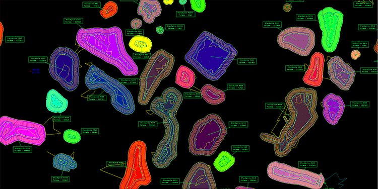
Data from the survey is input into LSS modelling software to produce accurate volumes of stockpiles, or to calculate earthworks volumes.
We provide independent professional services to both quarry operators and earthworks contractors, as a means to agree on contractual quantities.
What is a volumetric survey?
A volumetric survey is a survey that accurately measures the volume of a stockpile or of earthworks.
What is a volumetric survey used for?
Volumetric surveys are used to provide an independent measure on quantities for quarry operators and sub contractors to allow a bill of quantities to be agreed on.
What can you expect from our surveys?
With our volumetric surveys, you will get qualitative and quantitative data supplied in a 3D format, as well as aerial photography and video if specified for the project.
Our recent volumetric surveys
- Stockpile volumes of contract crushed material in one of Co Durham’s largest quarries.
- Volumes of imported material for quantity verification at Immingham docks.
