In this detailed guide, we will review the many forms of land surveys and emphasise the multiple advantages they provide for various projects.
In the world of building and land development, land surveys are a crucial tool. These surveys offer precise measurements, thorough mapping, and essential details regarding a piece of land’s physical qualities. A land survey is essential for ensuring accuracy and success while planning a construction project, determining property boundaries, or evaluating topographical features.
In this comprehensive guide, we will explore the different types of land surveys and highlight the numerous benefits they offer for various projects.

Topographic Surveys
Topographic surveys capture the physical features of a particular area of land, including elevation, slopes, vegetation, and other natural or man-made features. This detailed mapping allows architects, engineers, and designers to plan and design structures that effectively integrate with the existing terrain. With Landform’s topographic surveys, you can obtain precise elevation data and contour maps, enabling you to optimize your construction projects while considering environmental factors.

Setting Out
Setting out involves marking the exact positions of planned structures, utilities, roads and other elements on the ground before construction commences. By minimising errors and rework required during construction, this process saves both time and money.

Measured Building Surveys
Measured building surveys involve taking exact measurements of existing structures and mapping them. These surveys are vital for repair, refurbishment or extension projects because they allow architects and designers to precisely analyse the current status of the structure. Measured building surveys give detailed floor plans, elevations and sections, allowing for more efficient design procedures and verifying structural compatibility.

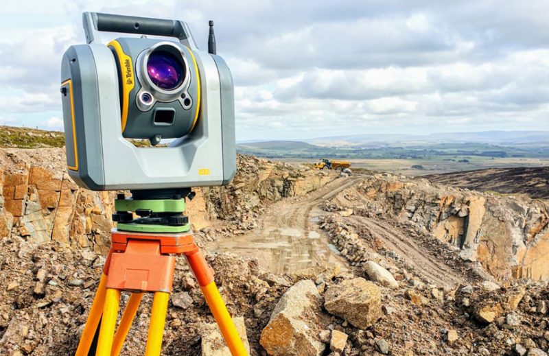
3D Laser Scanning
3D laser scanning is a cutting-edge surveying technique that captures millions of data points to create a highly accurate three-dimensional representation of a site or structure. This technology is particularly valuable for complex commercial projects, allowing for detailed documentation, clash detection, and accurate measurements. 3D laser scanning enhances project coordination, reduces errors, and enables effective design and construction planning.

Bathymetric Surveys
Bathymetric surveys are carried out in bodies of water like lakes, rivers, and coastlines. These surveys determine the depth, contours, and composition of bodies of water, giving critical information for maritime development, dredging, environmental evaluations, and navigation. Bathymetric surveys aid in the planning of marine infrastructure, coastal development, and the preservation of safe waterways.

Monitoring Surveys
Monitoring surveys involve the continuous or periodic measurement and analysis of structures, such as buildings, bridges, and dams, to monitor their movement, settlement, or deformation over time. These surveys help identify potential risks, ensure structural integrity, and inform maintenance or remedial actions. Monitoring surveys are vital for the long-term safety and stability of commercial structures.

Drone Surveys
Drone surveys acquire high-resolution aerial imagery and data using unmanned aerial vehicles (UAVs) or UAS (unmanned aerial systems) outfitted with cameras. This technology allows for rapid and low-cost data collecting across wide regions, or areas that are hard to reach, making it ideal for site inspections, progress tracking, volumetric calculations, and 3D modelling. Drone surveys improve project visualisation, efficiency, and safety on commercial sites.

Elevation Surveys
Elevation surveys are designed to collect correct elevation data for a building or structure, such as door/window openings, ornate stonework, roof heights, and clearance heights. These surveys can be used for condition surveys for a building, as well as planning requirements.

Utilities Surveys
Underground utilities such as water pipelines, gas lines, electrical cables and telecommunications equipment are mapped and located during utilities surveys. Utility identification and mapping help to avoid costly damages during excavation and building activities. Utilities assessments improve safety, reduce disturbance, and improve project planning.

BIM Surveys
Building Information Modeling (BIM) surveys create a digital representation of a building or infrastructure project. The aim of BIM surveys is to generate a comprehensive and accurate 3D model that encompasses both the physical and functional aspects of a project.
Benefits of Land Surveys
All of the identified types of land surveys offer a range of benefits that are invaluable for various purposes and projects. Here are some key advantages of land surveys:
- Facilitating Land Development: data from topographic surveys aids in site planning, infrastructure design, and determining the suitability of the land for specific uses.
- Ensuring Accurate Construction: staking minimises construction errors, aids adherence to design plans, and saves time and money by reducing rework.
- Assessing Environmental Factors: understanding environmental variables is essential for building structures that are environmentally friendly, improving site layout, and minimising environmental damage.
- Site Analysis and Planning: stakeholders can make strategic decisions about site selection, infrastructure placement, and project feasibility by understanding the features of the land, such as its topography, soil composition, and environmental conditions.
- Historical Documentation: historical land borders and changes can be traced by keeping survey records, which aids in legal disputes, land-use planning, and preserving an area’s historical context.
Land surveys have many advantages, such as establishing property boundaries, facilitating land development, ensuring accurate construction, assessing environmental factors, ensuring regulatory compliance, assisting with site analysis and planning, and contributing to historical documentation. These benefits emphasise the importance of land surveys in a wide range of enterprises and endeavours.
