Over the past ten years, drone surveys have continued to be a popular surveying method due to the associated benefits. Keep reading to find out everything you need to know about drone surveys.
What are drone surveys?
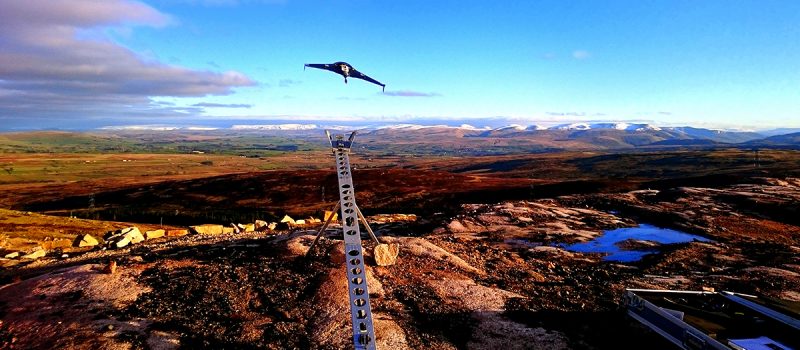
A drone survey involves the use of a drone, otherwise known as an unmanned aerial vehicle (UAV), to capture aerial data with downward-facing sensors, such as RGB and LIDAR payloads. Drone survey sensors use a number of different angles to ensure accurate data points are captured, including elevation points, georeferences and colours. The data points that have been gathered during the survey are then assimilated into a 3D Point Cloud, which can be used to produce a digital terrain model of the area mapped.
Drone surveys offer versatility and can either be used as a standalone solution or as a complementary add-on service alongside more traditional surveying methods.
What are the benefits of drone surveys?
Drone surveys have a number of associated benefits, including:
Accuracy – UAV and camera technology has improved significantly over the past decade, and drones are now able to use cameras that can shoot up to 5.2k resolution images and video. In addition to improved camera technology, stabilisation techniques have also advanced, enabling drones to capture images in the most severe weather condition.
Time effective – Drone surveys can reduce the overall project length, as they require little down time, making it a suitable surveying method for projects that have a strict time constraint.
Cost effective – Drones have relatively low overheads and can significantly reduce surveying costs for your project compared to other
Improved Health and Safety – The use of a drone eliminates the need for individuals to work at a height during a survey, reducing the risk of accidents occurring.
Minimum Disruption – When surveying with traditional equipment, It is common for access to a site having to be closed off and operations suspended when a survey is conducted with traditional equipment. However, using a drone to complete the survey minimises disruption to the surveying area, and requires little down time.
Find out more about the associated benefits of drone surveys in our Five Benefits of Using Drone Surveys article.
Drone Surveys with Landform Surveys
At Landform Surveys, we have a vast range of experience in providing drone surveys for a variety of clients. Our drone surveys can be carried out alongside other surveying methods to provide data on difficult to survey areas of a project. Find out how we combined surveying methods on a roof survey for a historic hall in North Tyneside.
All of our drone pilots at Landform Surveys are licensed and certified by the Central Aviation Authority (CAA), having undergone proper training and examinations to fly a drone for commercial purposes.
If you are interested in finding out how your project could benefit from a drone survey, please contact our surveying specialists today.
