In this article, we’ll outline how this technology works, how we deliver its data to clients as well as some of the benefits of a 3D laser scanning survey.
3D laser scanning has changed the way land and buildings are measured in recent years.
This cutting-edge technology uses 3D laser scanners to collect accurate spatial data, which lets full models of physical environments be made.
In this article, we’ll outline how this technology works, how we deliver its data to clients as well as some of the benefits of this survey type.
How a 3D laser scanning survey works:
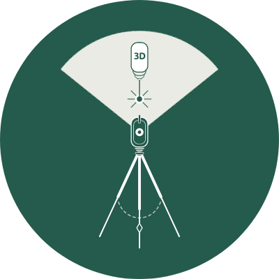
A 3D laser scanner sends out laser beams in different directions, measuring distances to objects by calculating the time it takes for the emitted laser pulses to bounce back.
These scanners are equipped with high-resolution cameras, aiding in capturing colour and texture details. By utilising multiple scans from different positions, a comprehensive 3D point cloud can be created, which represents the scanned area.
The data capturing process:
During a 3D laser scanning survey, scanners are strategically placed at different vantage points to cover the entirety of the area or building being surveyed.
The scanner collects millions of data points, creating a detailed point cloud model. This model accurately depicts the scanned space, including intricate details such as textures, dimensions, and even minute irregularities.
How information is delivered to clients:
Once the scanning process is complete, special software is used to handle the collected data. The 3D point cloud model that is made can be sent in a number of different forms, such as CAD (Computer-Aided Design) or BIM (Building Information Modelling) files.
The end product can also be published in Trimble Realworks Viewer format. With a free plug-in, you can view, change, zoom in on, measure, and make notes on point cloud image data.
It’s quick and simple to use, and it lets you get coordinates and measured lengths from point cloud data. We can give you scans in a number of formats, such as 2D and 3D AutoCAD drawings, point clouds, and rectified images.
Advantages of 3D laser scanning surveys:
Accuracy and precision: 3D laser scanning gives very exact measurements, which cuts down on possible mistakes during the building and design process.
Timesaving: traditional measuring methods often take a long time. 3D laser scanning on the other hand speeds up the data collection process, saving time and resources.
Comprehensive data: laser-scanned models hold a lot of information which is useful for building engineering and architecture.
Reduced costs: 3D laser scanning streamlines the survey process, and makes sure details aren’t missed as often, which lowers project costs overall.
Non-contact data capture: these surveys are also non-contact and non-invasive, making them the best option for sensitive environments, such as heritage sites.
Choose Landform Surveys for your next 3D laser scanning survey
At Landform, we use the latest 3D scanning technology, capturing over 1 million points per second to produce extremely high levels of detail and functionality. If you have a project that requires a 3D laser scanning survey, contact us for more information.
