In this blog post, we will explain how drone surveys are used in archaeology, and how they help to cover more ground, capture accurate data, and explore inaccessible locations.
Using drones in archaeological surveys is one of the most exciting archaeological developments in recent years. Prior to drones, providing accurate archaeological site models were not only costly, but traditional ariel photography methods or ground based operations were time consuming as well.
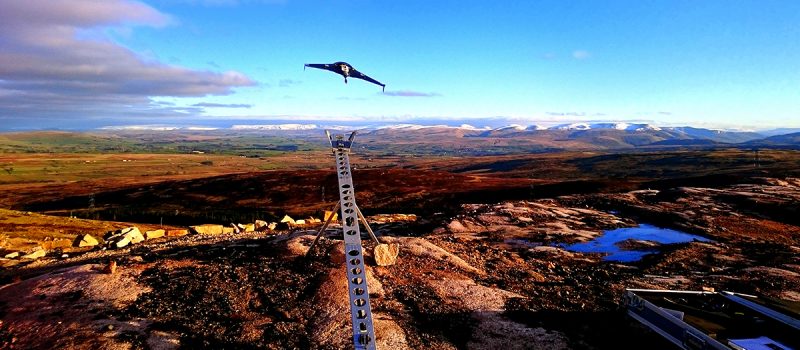
Utilising unmanned drones, also referred to as a UAV (Unmanned Aerial Vehicle) allow archaeologists to cover more ground than they could on foot, and — because they can take pictures from all angles — their data is accurate and comprehensive.
What are drone surveys?
A drone survey uses an unmanned aerial vehicle (UAV), often known as a drone, to collect airborne data with downward-facing sensors like RGB and LIDAR payloads. Drone surveys are flexible and can be utilised either as a stand-alone solution or as an additional service to go along with more conventional surveying techniques. You can read more about the benefits of drone surveys in our guide, where we discuss the further benefits of this type of surveys for all types of commercial projects.
How drones are used for archaeological surveys
Drones have enabled archaeologists and historians to collect data faster than ever before. Drones are now used in archaeology for tasks including:
- Documenting and recording new discoveries
- Assisting in planning for future dig sites
- Assessing damage to ancient sites from natural disasters or human activity
- Monitoring illegal excavation and looting of artefacts
- Assisting in digital reconstruction of ancient sites
Advantages of drone surveys for archaeology
There are many advantages of using drone surveys for archaeology instead of more traditional methods of site surveying:
- Data collection
The traditional methods of surveying frequently entail demanding fieldwork and manual measurements. Drone surveying can swiftly cover large areas, collect data effectively and accurately, and save the time and labour necessary for data collection.
- Preservation
Numerous archaeological sites are fragile and can easily be damaged by foot. Drones allow researchers to visit and record locations without endangering the environment’s physical integrity. Furthermore, utilising this technology allows for archaeologist to return to the site more often and helps with preservation through data longevity.
- Comprehensive site documentation
Archaeologists can use drones to collect high-resolution photography and produce granular maps of the sites. This information can be made into three-dimensional models, giving the site a thorough visual depiction.
- Inaccessible Locations
Drones are particularly useful in reaching remote and inaccessible locations that are challenging for archaeologists to explore on foot. Drones can travel through dense forests or challenging terrain, providing access to previously inaccessible locations.
If you are interested in finding out how your project could benefit from a drone survey, please contact our surveying specialists today.
