We’ve built long-standing relationships up with councils in the North East over the years, and we’re pleased to be their trusted surveyor to support them in the area.
Over the past few months we’ve been working closely with one local council to survey six bridges in their region.
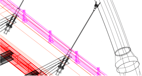
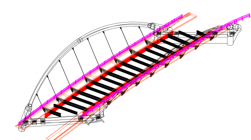
As you can imagine, bridges must be surveyed regularly to check that they are structurally sound and safe for footfall and traffic. We use a combination of techniques such as topographic survey methods and laser scanning which identify the boundaries of the structures and captures data points which are then mapped.
Using our Trimble TX8, 1 million points can be captured per second! This is key to producing detailed reports that can highlight areas of attention. Laser scans can also be used to produce photo realistic representations and visualisations of the bridges, combining the scan data with HDR photography.
On this particular survey, the requirement was to produce very detailed 3D as built drawings of the structures, showing all steelwork, abutments, supports, anchor points barriers etc, which meant a very comprehensive laser scanning survey had to be undertaken.
As with many projects near water, we must consider the survey timings to plan them at low tide. We also must manage the health and safety of our surveyors around tidal waterways – this is also where our equipment can help as our instruments have a scanning range of up to 340m – meaning we can safely conduct the surveys required.
If your project needs a bridge survey, topographic survey or 3d laser scanning survey don’t hesitate to get in touch!