Latest News
A topographic survey, also known as a land, topo or terrain survey, is a vital component in the design process for a site and should be commissioned before any detailed design works take place.
Measured building surveys can be conducted on all built structures, regardless of age. We have surveyed buildings of all ages and conditions, from historical manor homes to industrial units.

A 3D laser scanning survey works by collecting data points from a building or structure remotely and at a speed and level of detail that conventional survey techniques cannot match. It is a non-invasive technology that captures a set of data points (the point cloud) and maps them on a grid coordinate of x, y and z.

Amongst their other expertise, Landform Surveys are Hydrographic Surveyors – providing bathymetric surveys across the North East.
Landform Surveys can provide a monitoring regime to identify any movement of buildings, structures, earthworks, slopes etc.

Landform Surveys offers drone surveys to acquire aerial data and produce surveys for difficult to access areas, such as quarries. This makes surveying accessible to areas that were previously too expensive or out of reach.

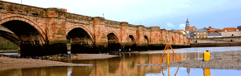
We have carried out elevation surveys of a wide variety of structures throughout the UK, including bridges, historic buildings and churches, office blocks and hotels. Detailed and accurate elevations of buildings and structures are required for many building schemes.

The detection and mapping of utilities surveys can be one of the most beneficially proactive surveys done before a building project.

With the growing adoption of BIM by the construction and property sectors, quality measured survey data is integral for many projects and there has seen a steady increase in demand for the delivery of measured surveys in a 3D Revit format. BIM surveys can be used to inform design decisions.

We have provided volumetric surveys to accurately calculate stockpile volumes, extraction quantities, and volumes of earthworks.

Landform Surveys can provide experienced setting out engineers to accurately mark out positions on the ground extracted from drawings and plans.

Quarries and minerals are a valuable resource that must be evaluated and managed properly. Our quarry surveys help you to protect this asset by providing accurate data to aid in decision-making.

With climate change becoming an ever larger social and economic concern, flooding is projected to increase across the UK. We can provide survey information to allow a Flood Risk Assessment Consultant to prepare a report on the likelihood of a site flooding

Latest Case Study
Precise control survey on major development in Teesside
Landform Surveys were approached by a client working on a major development in Teesside to support with a control survey to gather measurements and data. The project required a precise check on existing control stations periodically to ensure accuracy which was critical to the development.
Contact Us
To find out more about how Landform Surveys can support you, send us a message.
