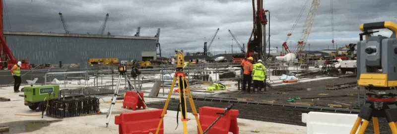
3D laser scanning has been a great advancement in technology that has been helpful in many industries, including the surveying. But how does it work? It can seem like magic, but the principles behind it are quite simple but used in an innovative way. As with all equipment in surveying, its main purpose is to collect highly accurate measurements. There are two main methods that a 3D laser scanner gathers data - the time of flight and triangulation. Both are nondestructive and non-contact, making them ideal for the majority of scanning and surveying projects.
Time of Flight
Time of flight scanners use the speed of light, which is a constant, to measure how far away a point is. The time is measured when the light leaves the scanner, reaches the object and returns to the scanner. This time measurement is then used to calculate distance based on long it has taken the light to leave return to the scanner. The accuracy of this measurement is determined by how accurate the scanner’s chronometer is and can vary from device to device.
While time of flight scanners have a great capacity to take measurements over a long-distance, the trade off is diminished accuracy. As the measurement of a measure as minuscule as the measurement of time is difficult, a time of flight scanner may not be suitable for projects requiring highly accurate measurements.
Triangulation
Triangulation scanners are another method of laser scanning that can be used to capture 3D measurements. Triangulation calculates 3D coordinates by forming triangles from known points and measuring the position of a spot from a beam of light. These points are then collected by a computer and saved for later reference as points are used to make models when they are relational to each other.
Triangulation is more accurate than a time of flight and a lot of handheld scanners use triangulation for measuring smaller objects. While these are useful, the ones used by surveyors are generally mounted on a tripod as they are scanning larger items such as buildings.
Point Clouds and Registration
As scanners can only record what’s in their line of sight, multiple scans be done to create a model and a single scan is usually not sufficient to create a complete model. But as these scans are held as separate data sets in order to create a 3D model, the data must go through a process called alignment or registration in order to be used in models. This is when the point cloud data is brought into common reference and merged. This can then complete a model.
Using photographs captured by the scanner at the time of the survey, the point cloud can then be colourised to produce a point cloud in full colour.
So while a 3D laser scan can be time consuming as scans need to be taken from different vantage points, it is amazing that 3D models can be created, stored and manipulated from this data as it is not something that can be done with traditional survey methods.
As research into laser scanning continues, the technology continues to improve over time and become more accurate.
If you have a project that requires 3D laser scanning, get in touch.
