As technology has developed, topographic surveying has been transformed. Gone are the long, arduous days spent working out map points manually. Now that global positioning systems (GPS) are standard, previously time-consuming and labour-intensive tasks can be completed in half the time.
One of the most exciting technological developments for topographic surveying is that of the unmanned aerial vehicle (UAV) or drone. In this blog, we take you through how drones came into usage for topographic surveys, and how they're revolutionising traditional industry processes.
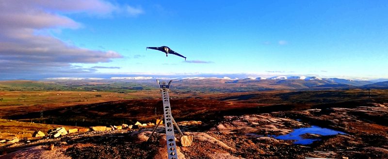
How are drones being used for topographic surveying?
Drones can be used to collect topographic surveys over large areas where otherwise traditional survey methods would be very time-consuming. Digital photographs are collected by the drone, with control points marked on the ground and co-ordinated. Using the same principles of traditional photogrammetry, a digital terrain model is created that records the topography of the ground.
Drones can be of assistance in other types of surveys, such as building surveys, where inaccessible roofs can be surveyed, and in quarry surveys, where safety considerations may prevent full access.
Drones offer a number of benefits to topographic surveyors. They can:
- Reduce overall survey time
Using an aerial survey drone, topographic surveyors can get an aerial view of the land they are surveying. Drones, equipped with the right software and data capture sensors (such as Lidar scanners) can be used to greatly reduce the time needed to deliver highly accurate topographic survey mapping. - Link with ground control points
Established ground control points are crucial for ensuring the accuracy of a drone-led topographic survey. Using specialist software, a drone is able to link its data capture with accurately geolocated orthophotos and point clouds. - Offer increased team safety
By entrusting the bulk data capture of a topographic survey to a drone, surveyors no longer have to manually collect data in areas where the terrain or surrounding environment is dangerous. This makes the overall process far safer and keeps field professionals productive and safe on the ground. - Drones can be equipped with a range of specialised sensors, cameras, and other data capture devices in order to deliver the best topographic survey possible. As time goes on, we expect to see drone surveying develop into an even more sophisticated topographic surveying method, used as standard across the globe.
Topographic Surveying | Landform Surveys
Landform Surveys uses a combination of traditional and modern methods in order to deliver the highest quality topographic surveys possible. Our investment in the latest Trimble S6 and S3 Robotic Total Stations, and Trimble R6 & R8 GPS receivers, as well as drone technology, means we are capable of producing detailed, accurate topographic surveys quickly and with great professionalism.
Interested in drone topographic surveying? Get in touch with a member of the Landform team today.
