As technology continues to change the way we live and work, there will come a day when
automation plays an even larger part of how data is gathered and processed. This includes how surveying might be conducted in the future. Automated surveying would allow for even further ease of drone surveys, and would extend to other current surveying techniques.
Land surveying
It would be great to go out into the field, set up an instrument and just let it do all the measurements on its own. But that’s probably not going to happen any time soon. And it would probably be stolen! However, certain data capture can be automated depending on what it is capturing. River levels can be captured by automated systems in real time to record flooding and give live data throughout the lifecycle of a flood, which is a helpful addition to survey data gathered when river levels are at a safe level.
Monitoring survey
As monitoring surveys are designed to capture movement over time, automated systems have already been created to assist with real-time monitoring surveys, as computers can detect change points and feedback to a central system as well as continue to capture data points. This depends on the location and type of structure being surveyed, especially if there is localized disruption to it that may affect the validity of data points.
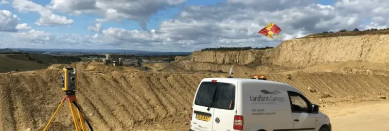
Volumetric surveying
Similar to monitoring surveys, Automation could help with volumetric surveying, measuring the amounts of mineral that have been extracted in real-time over a given time. Depending on the mining activity this might not be feasible, especially as there is lots of extraction activity on site, but even running automated drone surveys could help with data capture.
Issues with automation
Of course there is going to be issues with automation with the technology we currently have. It takes years of training to be a surveyor, and it would be difficult to replace those skills by automation. It is possible that automated systems may capture data twice and it could be difficult to identify where there is an overlap.
Artificial intelligence is needed to be able to recognize items and features on their own. The images captured by drones would have to be processed with software that has that capability. It is easy to mistake a street light or telephone pole for a tree, so the data will still have to be verified by a trained professional.
One day we may well see automated systems providing a helping hand to busy surveyors!
Looking for a surveyor for your next project? Get in touch! (https://www.landform-surveys.co.uk/contact-us/)
